Las Vegas Blvd. is such an iconic road, from downtown through the Strip and past it. Where does it start and where does it end? How long is it in total? And does it carry any particular official designation for it being so famous?
To answer your second question first, yes, Las Vegas Boulevard is also known as the Las Vegas Strip National Scenic Byway.
The Las Vegas Strip was declared "America’s first nighttime scenic byway" on June 30, 1995, by the director of the Nevada Department of Transportation (with some encouragement from the Nevada Commission on Tourism, the Las Vegas Convention & Visitors Authority, and the Clark County Comprehensive Planning Commission). It was designated an "All American Road" and recognized as a nighttime scenic byway by the Federal Highway Administration on June 15, 2000.
The Strip Scenic Byway stretches from Sahara Avenue to Russell Road. To maintain the designation, signs along the four miles of the Strip must be well-maintained and new signs require a certain amount of neon and animation. There’s also a little funding involved from a National Scenic Byway Grant committee.
(For your further information, there are three other official federal National Scenic Byways in Nevada: 29 miles of Eastshore Drive along Lake Tahoe, from just south of Incline Village to just north of Zephyr Cove; 37 miles along the shores of Pyramid Lake north of Reno, the nation’s only Byway completely within a Native tribal reservation; and 12 miles of road that ascends Great Basin National Park, the highest road in Nevada that climbs 3,400 feet and terminates higher than 10,000 feet in elevation.)
As for where Las Vegas Boulevard starts and ends, it has a north and south designation. In the north, it begins at Moapa Paiute Solar Road, a little more than three miles north of the intersection of US 93 and I-15.
In approximately 22 miles, just north of West Owens Avenue, it veers off to the left/west (N. Main Street continues straight).
Las Vegas Boulevard crosses Fremont Street between Fourth and Sixth streets (which is why it used to be called Fifth Street). As soon as it crosses Fremont, it becomes Las Vegas Boulevard South.
Officially, the Las Vegas Strip starts at Sahara Avenue. The Strip continues to Russell Road, just south of Mandalay Bay. For reporting purposes, the Nevada Gaming Commission considers "the Strip" all the hotels between the Sahara and Mandalay Bay, plus one mile on either side. On the west, that includes the Rio, Palms, and Gold Coast, though not the Orleans. On the east side, that includes the Westgate, Silver Sevens, Hooters, and the Hard Rock/Virgin, plus several smaller joints like Ellis Island.
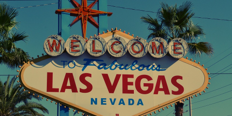
Beyond Mandalay Bay, the Strip turns back into Las Vegas Boulevard South, passing the Welcome to Fabulous Las Vegas sign, South Point, and M Resort.
The Boulevard continues due south for a half-mile past M Resort, at which point it veers west and parallels Interstate 15 all the way to Jean, then on to Primm, where it dead ends just north of the Primm Valley Motorsports Complex.
Altogether, from its start at Moapa Paiute Solar Power Rd. to Primm, Las Vegas Boulevard is approximately 66 miles long.
 |
Dave
Nov-17-2019
|
 |
gaattc2001
Nov-17-2019
|
 |
Kevin Rough
Nov-17-2019
|
 |
Roy Furukawa
Nov-17-2019
|
 |
Nov-17-2019
|